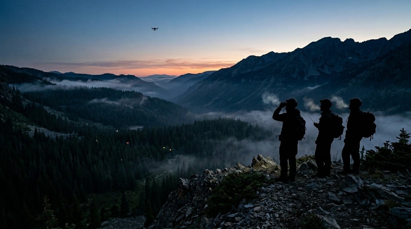
When minutes decide outcomes, a thermal-equipped drone gives search teams a way to see what the human eye and daylight can't.
- Thermal imaging search and rescue works by spotting the heat a body gives off against a cooler background, which is why night and low-visibility searches often succeed where ground crews and daylight fail.
- The specs that decide a mission are practical: sensor resolution, thermal sensitivity, the lens paired to the sensor, and field-proven durability.
- Agencies from local police to volunteer fire departments are already closing cases in minutes that once took hours, and the public record keeps growing.
- Procurement details that rarely make the brochure, like NDAA compliance and a stable optics supply chain, separate a dependable program from a grounded one.
Before you compare platforms, get clear on the missions you fly most, because the right SAR drone camera is matched to your terrain, your hours, and your compliance requirements.
When a hiker disappears into a canyon at dusk or a flood strands families after dark, the clock starts immediately, and the odds drop with every passing hour. That pressure is why thermal imaging search and rescue has moved from a specialized capability to standard equipment for public safety teams across North America. The global search and rescue drone sector was valued at $3.76 billion in 2024 and is projected to reach $13.49 billion by 2034, with North America expected to hold close to a third of that demand.
This guide is written for the people who actually field these programs: fire departments, volunteer SAR organizations, and the public safety procurement officers who sign off on them. The goal is to help you read the specs, match a system to your missions, and know what to demand from the advanced infrared imaging technology built into the platforms you buy.
What Makes Thermal Imaging Search and Rescue So Effective?
Thermal imaging search and rescue is the practice of using infrared sensors, usually mounted on a drone, to detect the heat that living bodies radiate and to separate a person from the cooler ground, water, or vegetation around them. A thermal sensor doesn't need any visible light at all. It reads long-wave infrared energy in the 8–14 micron band that every warm object emits, which is why a search can keep going in total darkness.
Peer-reviewed research on drone-based thermal tracking has shown that a thermal camera on a UAV can detect and follow people across difficult terrain even when subjects are partly hidden or moving unpredictably. For a team on the ground, that translates into covering more area faster than a foot search ever could.

Why Night and Low-Visibility Searches Favor Thermal
The contrast a thermal sensor relies on actually improves after sunset. As the ground gives up its heat, a warm body stands out more sharply against the cooling landscape, so night flights are often more productive than midday ones. Thermal also cuts through smoke, light fog, and darkness, and it can catch heat radiating through gaps in a tree canopy that a spotlight would skip right past. That combination is why so many thermal imaging systems do their best work in conditions that defeat a standard camera.
Where Thermal Has Real Limits
Thermal isn't a magic window, and credible programs plan around the gaps. Heavy rain and dense, wet canopy absorb infrared and can mask a heat signature entirely. High-radiance surfaces, like sun-baked rock or pavement in the middle of the day, flatten the temperature contrast a sensor depends on. Understanding these limits is part of running an honest thermal imaging search and rescue operation, and it's the reason good teams pair thermal with visual cameras and ground crews rather than treating any single tool as the whole answer.
Which SAR Drone Camera Specs Matter?
A spec sheet for a thermal payload can read like alphabet soup, but for search and rescue, only a handful of numbers change outcomes in the field. The trick is reading them as a buyer who needs to find people, not as an engineer who needs to win a lab benchmark.
Resolution and Sensitivity: Seeing a Person, Not a Blur
Two specs do most of the work. Resolution, often expressed as a 640x512 sensor versus a 320x240 one, decides how much detail you get from altitude, which decides whether you can tell a person from a deer or a warm rock. Sensitivity describes the smallest temperature difference the camera can pick out, and the better uncooled cores resolve differences of just a few hundredths of a degree, enough to separate a hypothermic body from cool brush. Pair a higher-resolution sensor with the right precision infrared optics, and you can search effectively from a safer, higher altitude.
|
Spec |
What it tells you |
Why it matters for SAR |
|
Resolution (e.g. 640x512) |
Detail captured at distance |
Confirms a human shape versus a false positive from altitude |
|
Sensitivity |
Smallest temperature difference detected |
Picks out a faint, cooling body against the background |
|
Lens and field of view |
Coverage area versus reach |
Wide for area sweeps, narrow for long-range confirmation |
|
Frame rate |
Smoothness of the live feed |
Steadier tracking of a moving subject |
|
NDAA compliance |
Approved component sourcing |
Determines whether an agency can buy and fly it |
Cooled vs. Uncooled: Matching the System to the Mission
Most public safety thermal drone payloads use uncooled sensors, and for good reason. They're light, they sip power, and they fit small airframes, which is exactly what a fast-deploy mission needs. Cooled systems see farther and resolve finer detail, but they're heavier, draw more power, and cost more, so they tend to live on larger platforms built for very long-range work. For the majority of drone and UAV imaging missions that a fire department flies, uncooled is the practical choice.
|
Factor |
Uncooled thermal |
Cooled thermal |
|
Best for |
Fast-deploy, close-to-mid range searches |
Very long-range detection |
|
Size, weight, power |
Light, low power, small airframes |
Heavier, higher power draw |
|
Detail and reach |
Strong for typical SAR altitudes |
Finer detail at greater distance |
|
Typical platform |
Small to mid-size public safety drones |
Large, specialized platforms |
|
Relative cost |
Lower |
Higher |
The Procurement Box Most Buyers Forget: Compliance and Supply
Performance gets all the attention, but two line items decide whether a program actually stays in the air. The first is NDAA compliance. Many agencies now require that a drone and its sensors contain no covered foreign components, and a system that fails that test can't be purchased, no matter how well it performs. The second is supply chain reliability. Traditional infrared lenses rely heavily on germanium, a material with real availability and price swings, which has pushed the industry toward alternative infrared glass and broadband infrared options that don't hinge on a single scarce input. One more wrinkle worth knowing is that thermal cameras above certain frame rates can trigger U.S. export controls, which is part of why domestically built infrared lens assemblies and sensors tend to simplify procurement rather than complicate it.
What Are the Core SAR Drone Mission Profiles?
Not every search looks alike, and the mission you fly most should drive the system you buy. These are the profiles that show up again and again in public safety work, each with its own demands on the imaging payload.
- Wilderness and wildland searches. A lost hiker in dense terrain is a classic case, and thermal earns its keep by finding heat through gaps in the canopy that ground teams walk right past. These missions reward resolution and a stable feed because you're often confirming a faint signature from altitude. Rugged, long-endurance platforms matter here.
- Nighttime operations. This is the bread and butter of thermal imaging search and rescue. With the landscape cooling after dark, a body's heat signature pops, and a drone can sweep terrain that would be dangerous for crews to cross on foot. Many departments report that their most successful searches happen at night.
- Water and marine rescue. A person in cold water reads clearly against a cool surface, and because hypothermia sets in fast, speed is everything. A thermal payload can guide a boat crew straight to a target in darkness or light fog. Coastal and lake-region agencies lean on this profile heavily.
- Disaster and structural collapse. This is where disaster victim detection UAV work comes in, scanning rubble, flood zones, and debris fields for survivors. Crews often map large areas systematically, then flag heat signatures for ground teams to investigate. Coverage speed and durable optics carry the day.
- Urban and wandering cases. Missing children and adults with dementia frequently turn up in backyards, parks, and drainage channels close to home. A public safety thermal drone can clear these spaces in minutes, checking spots a vehicle or foot patrol can't easily reach. Quick deployment and a tight search radius define the profile.

How Are Agencies Using Thermal Drones Right Now?
The clearest argument for these programs is the case log. Across the country, agencies are turning multi-hour searches into minutes, and the public record is filling up with examples.
In October 2025, a Massachusetts police department located a missing and endangered person in a densely wooded area after a thermal drone picked up the heat signature that ground crews and a K-9 had lost. That kind of result has become almost routine for departments running a fire department thermal drone or police UAS as standard equipment rather than a special-event tool.
Disaster work tells a similar story on a larger scale. In a 2025 recovery operation in Central Texas, drone teams mapped about nine miles of creek bank and collected roughly 27,000 thermal images, deliberately flying in the early-morning hours once the ground had cooled enough for heat signatures to stand out. It's a textbook demonstration of the night-contrast principle put to work over a real search area.

The pattern across these stories is consistent: an aerial thermal payload arriving first and shrinking the search window, whether it's flown by a metro police force or a small volunteer crew.
How Do You Choose the Best Thermal Drone for Search and Rescue?
There's no single best thermal drone for search and rescue, only the best fit for your terrain, call volume, and budget. Use this checklist to narrow the field before you ever request a quote.
- Map your missions first. Write down your three most common search types because a marine-heavy unit and a wildland team have very different needs.
- Set a resolution and sensitivity floor. Decide the minimum sensor performance you'll accept, and resist the urge to under-buy the imaging core to save on the airframe.
- Match cooled versus uncooled to range and airframe. Most teams land on uncooled, but very long-range mandates may justify a cooled system.
- Confirm NDAA compliance and a documented supply chain. Verify component sourcing up front, and ask where the optics actually come from.
- Pressure-test durability and flight time. Match the platform's weather rating and endurance to the climate you operate in.
- Plan the program, not the purchase alone. Build in pilot training and the right FAA authorization path, whether that's Part 107 or a Certificate of Authorization for night and beyond-line-of-sight work.
For teams that want to go a level deeper on the imaging hardware itself, a closer look at drone thermal cameras for search and rescue is a useful companion to this buyer's guide.

Frequently Asked Questions
Can a thermal drone find a person hidden under tree cover?
Often, yes. A thermal sensor can detect body heat radiating through gaps in a canopy that block visible light, which is how teams locate subjects that ground searchers pass within yards of. The exception is dense, wet foliage, which absorbs infrared and can mask a signature, so heavy cover still calls for a coordinated search.
Is thermal imaging really better at night for search and rescue?
In most cases, it is. After sunset, the ground cools faster than a human body, so the temperature contrast that a thermal camera depends on actually sharpens. Many agencies schedule their searches for the overnight hours rather than midday.
What thermal resolution do search and rescue teams need?
A 640x512 sensor is the practical standard for serious work, since it gives you enough detail to confirm a human shape from a safe altitude. Lower-resolution 320x240 units can serve as an entry point, but they make it harder to tell a person from a false positive at a distance.
Do fire departments need a special license to fly a thermal drone?
In the United States, a public safety thermal drone program generally operates under FAA Part 107, with a Certificate of Authorization unlocking night flights, controlled airspace, and beyond-line-of-sight missions. Most departments start with Part 107 and add a COA as their operations mature.
What's the difference between a SAR drone camera and a regular drone camera?
A regular camera captures visible light and needs illumination to see, while a SAR drone camera reads the infrared heat an object emits, so it works in darkness, smoke, and light fog. That heat-based view is what lets it find a living person against a cooler background.
Ready to Field SAR Imaging Your Team Can Trust?
The agencies running the most dependable programs look past the drone's logo and ask what's inside the thermal payload because the sensor and optics are what actually find people. When you're specifying your next platform or advising the integrator who builds it, push hard on resolution, sensitivity, NDAA compliance, and a supply chain that won't strand you when germanium prices spike.
It pays to talk with the people who engineer the imaging core. LightPath designs and manufactures the vertically integrated infrared optics, assemblies, and camera systems that OEMs build into search and rescue platforms, with domestic manufacturing and germanium-alternative materials that keep programs both compliant and supplied. If you're building or specifying a SAR system, connect with the imaging team to make sure the core is mission-ready before it ever leaves the ground.